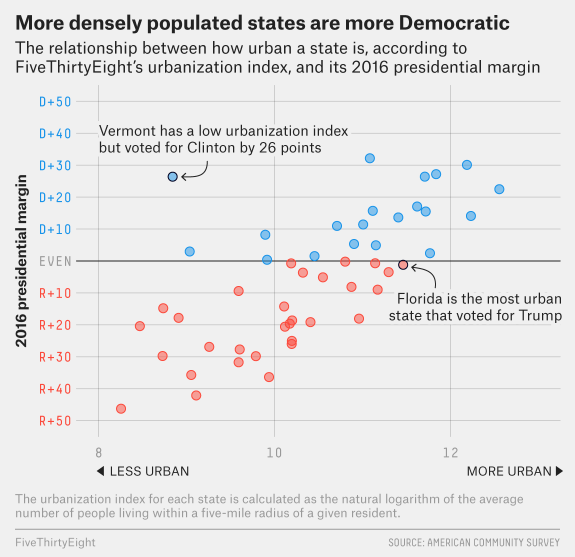
FiveThirtyEight has the interesting graph copied here from their article How Urban or Rural is Your State? And What Does That Mean For The 2020 Election? by Nathaniel Rakich (4/14/2020). How did they measure urbanization?
Essentially, we calculated the average number of people living within a five-mile radius of every census tract and took the natural logarithm to create an “urbanization index,” or a calculation of how urban or rural a given area is.
The article has a table of data that goes with the graph and they look at the 2020 election if urbanization dictated the outcome.