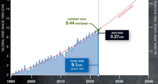
 If you aren’t sure how sea level is calculated then read NASA’s Sea Level 101: What determines the Level of the Sea? by Alan Buis (6/3/2020) . Here is one factor:
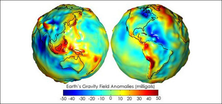
If our ocean had no tides or currents, the sea surface would assume the shape of the geoid. These “gravity anomaly” maps, based on data from the U.S./German Gravity Recovery and Climate Experiment (GRACE) mission, show where Earth’s gravity field differs from a simplified Earth model that is perfectly smooth and featureless. Areas colored yellow, orange or red are areas where the actual gravity field is large, such as the Himalayan Mountains in Central Asia (top left of the left-hand globe). The progressively darker shades of blue indicate places where the gravity field is smaller, such as the area around Hudson Bay in Canada (top center of right-hand globe). Credit: NASA/JPL-Caltech
If you are going to teach about climate change and related ramifications such as sea levels rising, then reading articles such as this one provides helpful background knowledge. Also, it’s just real interesting.