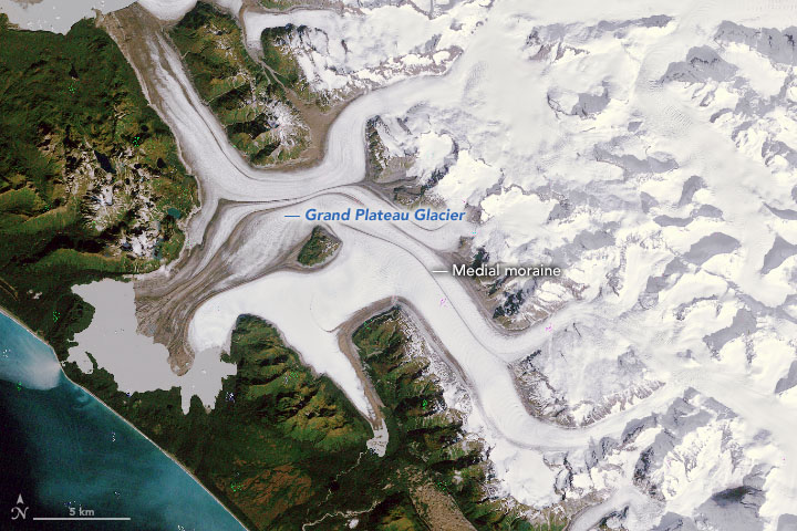
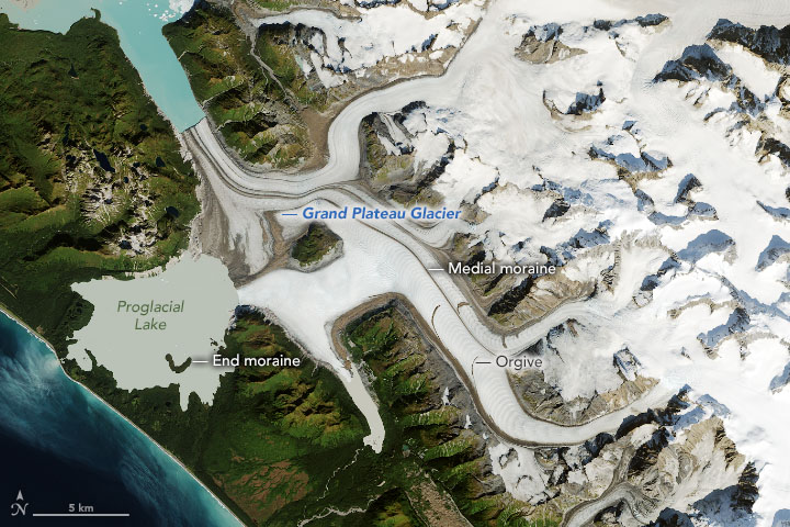
NASA’s earth observatory post Grand Plateau Glacier provides a pair of aerial images of the glacier, copied here, from 1984 and 2019, both from Sept of the given year.
In the images, a moraine near the coastline acts like a dam, trapping meltwater and forming a proglacial lake. Also note the end moraine visible poking above the surface of the lake in the 2019 image. This mound was left behind by a lobe of the glacier front that appears in the 1984 image.
Over the past 35 years, the entire flow of the glacier system changed. In the 1984 image, many of the glacier’s branches flow toward the lake to the southwest; by 2019, retreat caused some branches to change course and flow toward the northwest. Notice the change in direction of the thin brown lines tracing the flow of the glacier’s branches. These are medial moraines: rocky debris from the sides of glaciers (lateral moraines) that have merged, causing the debris to be carried down the center of the combined glacier.
Retreat is not the only change; Grand Plateau is also visibly narrowing and thinning.
Larger images are available covering more area on the page. There is also an option to view the images together with a slider going over the image to change the year and, of course, more information about the changes in the glacier.
There is a link to other glacial image pairs on the Misc Materials page.
