The climate.gov article Understanding the Arctic polar vortex by Rebecca Lindsey (3/5/2021) is a complete primer on the polar vortex, jet stream, and what we know (and don’t) abut the connection to climate change.
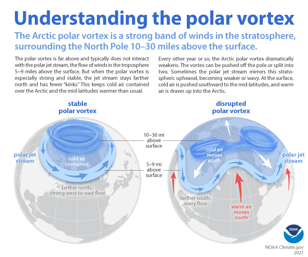
According to NOAA stratosphere expert Amy Butler, people often confuse the polar vortex with the polar jet stream, but the two are in completely separate layers of the atmosphere. The polar jet stream occurs in the troposphere, at altitudes between 5-9 miles above the surface. It marks the boundary between surface air masses, separating warmer, mid-latitude air and colder, polar air. It’s the polar jet stream that plays such a big role in our day-to-day winter weather in the mid-latitudes, not the polar vortex.
Any relationships to climate change is unclear, for example:
The uncertainty due to a relatively short history of observations isn’t the only reason experts can’t dismiss the possibility that something could be up with polar vortex. Some climate model experiments do predict that continued warming will lead to a weakening of the polar vortex. “It’s true that when you run some high-resolution climate models, with a realistic stratosphere, and a realistic sea ice layer, and you reduce sea ice cover, these models predict that the polar vortex gets weaker,” Butler said. And some studies combining models and observations have shown a connection between low sea ice extent in the Barents and Kara Seas of the eastern Arctic, sudden stratospheric warming events, and cold winters in North America.
At the same time, other model simulations predict that warming and sea ice loss will lead to a stronger polar vortex. Part of the reason for the disagreement is that the impact of Arctic surface warming and sea ice loss on the atmospheric waves that can disrupt the polar vortex is very sensitive to exactly where and when the sea ice loss occurs, and that hasn’t been consistent across model simulations.
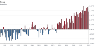
No data in this article but there are some useful graphs, such as the one copied here, and the article is just generally interesting.