The world ban blog looks at fertilizer prices in the post Fertilizer prices ease but affordability and availability issues linger by John Baffes and Wee Chian Koh (1/5/2023). In Europe
The sharp increase in natural gas prices in Europe has led to widespread production cutbacks in ammonia—an important input for nitrogen fertilizers. However, input costs have declined in recent months due to increase imports of liquefied natural for national reserves in Europe as well as expectations of a milder winter. This could allow some shuttered nitrogen fertilizer production facilities in Europe to resume operations.
In China
Supply concerns have been exacerbated by China’s extension of export restrictions on fertilizers until the end of 2022 in order to maintain domestic availability. DAP exports from China, which accounts for 30% of global trade in DAP, fell by nearly 50% (y/y) during the first ten months of 2022. Meanwhile, Chinese urea exports declined by about 60% (y/y) over the same period.
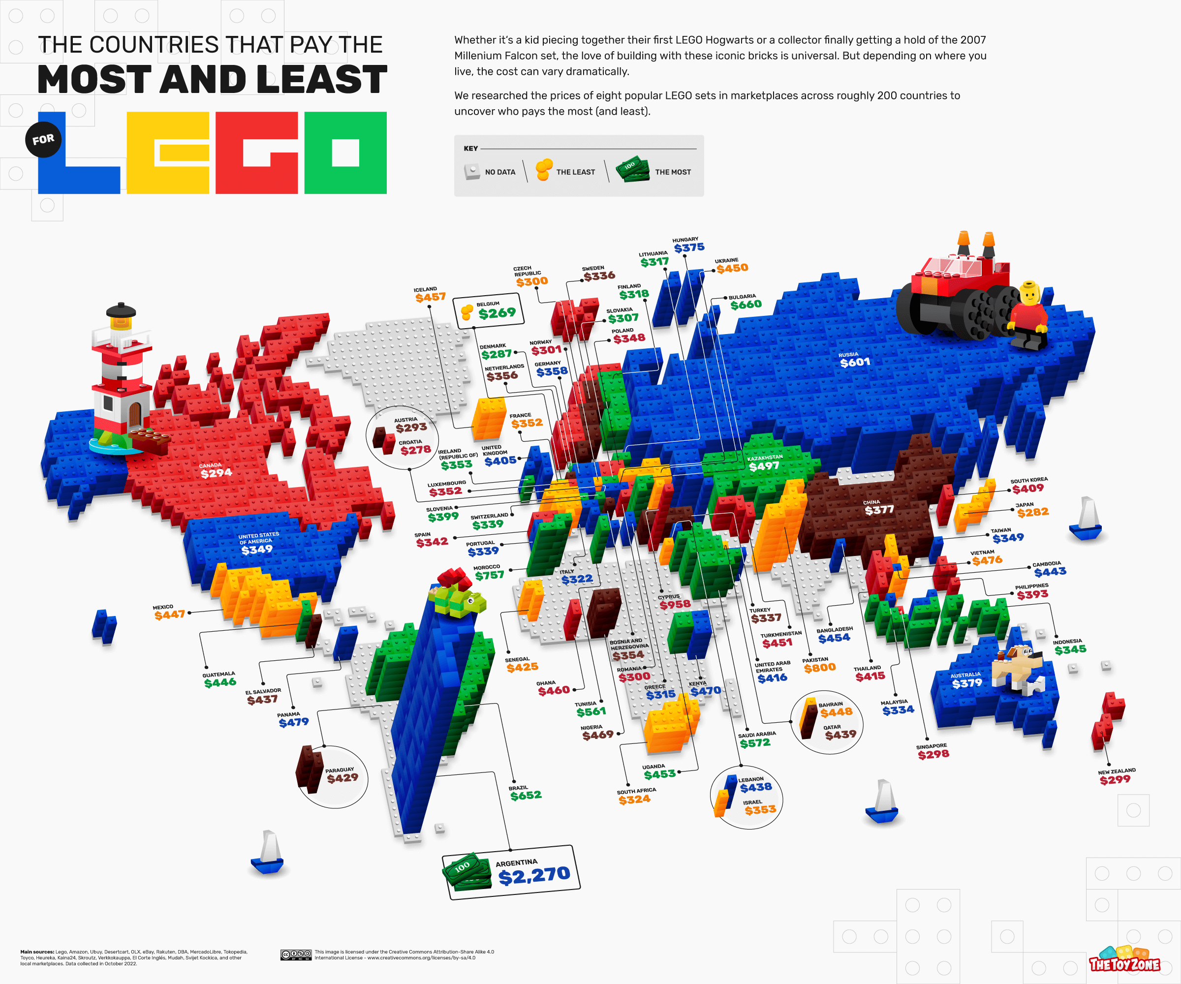
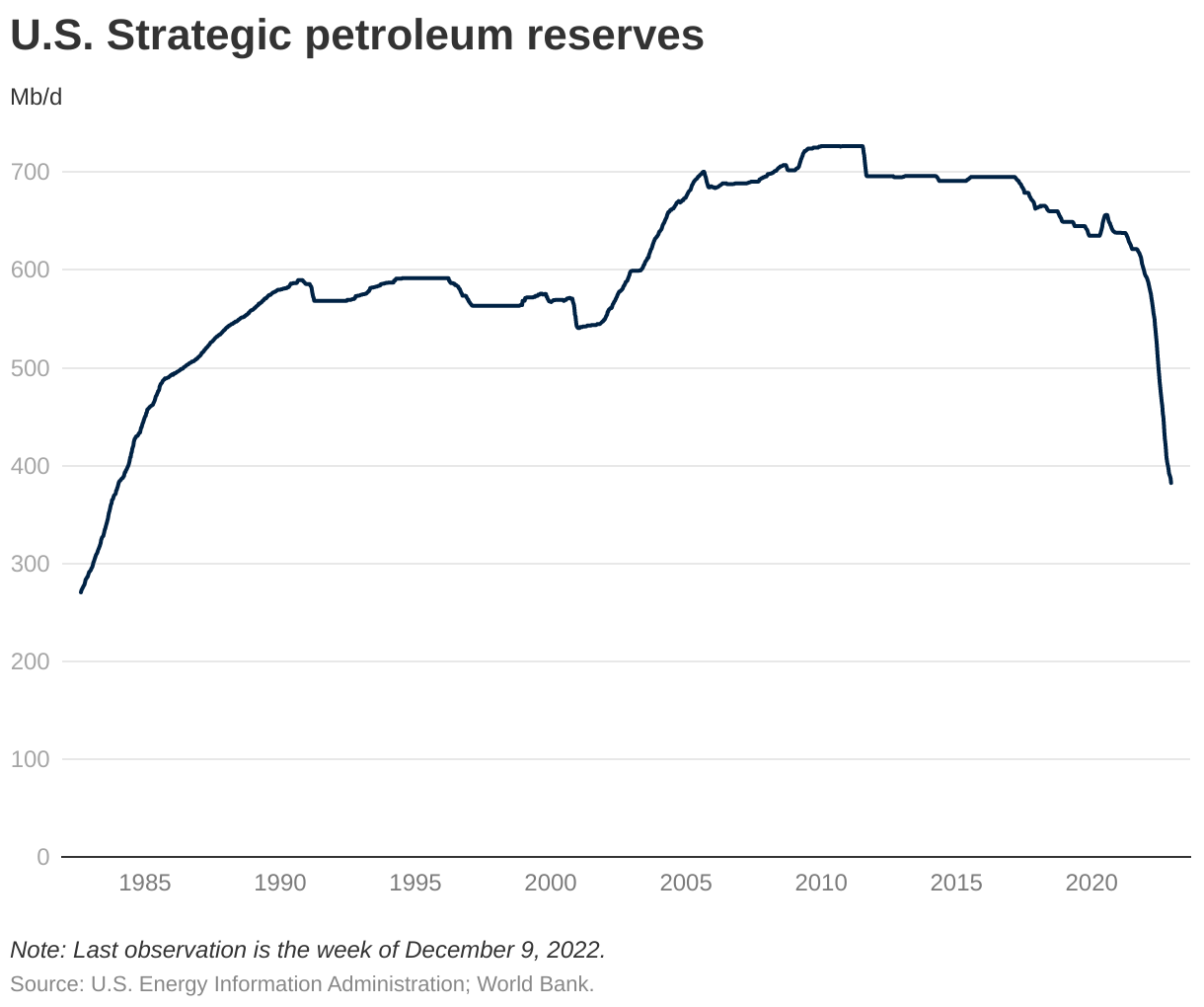
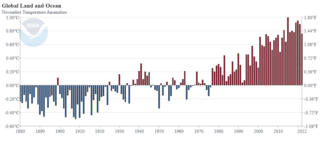
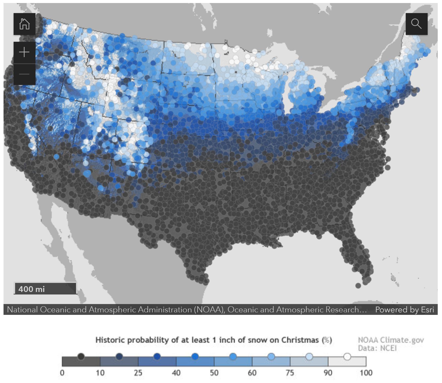
There are four graphs and a link to the Commodity Markets page that has a bunch of data.